2.3. Extending QGIS functionalities
2.3.1. Processing toolbox
Software functionalities can be integrated by activating the Processing Toolbox (from the main menu Processing → Toolbox).
The toolbox contains all the available algorithms, divided into predefined groups, which are called Providers. It includes also additional user created algorithms, allowing users to define their own workflows and processing tasks. At the top of the list of algorithms are displayed the most recent used tools, in such a way to make easier to re-execute them, if needed (Fig. 2.3.1.1). In the uppest part of the toolbox dialog, there are functionalities for managing models (1) and python scripts (2). Referring to models, the graphical modeler will be presented in a next lesson; on the opposite, scripts are not included in this basic training.
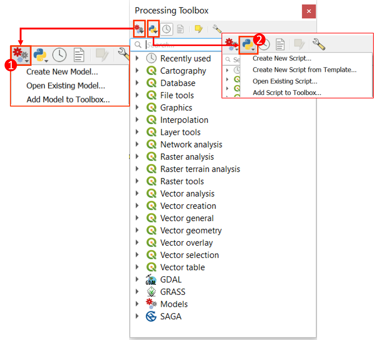
Fig. 2.3.1.1 – The Processing Toolbox, that allows to manage models and scripts as well
2.3.2. Plugins
They are subdivided in:
- core plugins,
- external plugins.
The former plugins are maintained by the QGIS Development Team and are automatically part of every QGIS distribution. Most of External Plugins are written in Python and stored either in the QGIS Repository at or in external repositories and are maintained by the individual authors. We will see together two examples of very used plugins: QuickMapServices and QuickOSM.
For managing plugins (install, uninstall, upgrade), use the Plugins Dialog, clickable in the main menu (Fig. 2.3.2.1). For installing QuickMapServices plugin, select from the main menu Plugins → Manage and Install Plugins (1). If you select All (2), you will see the list of the available plugin. Type QuickMapServices (3) and select it (4). Finally, click Install Plugin (5). Each plugin has some metadata, which are displayed in the right panel (see an example in Fig. 2.3.2.1):
- information on whether the plugin is experimental,
- description,
- rating vote(s),
- tags,
- links to the home page, tracker and code repository,
- author(s),
- version.
If you want, you can also directly install plugins in a zipped format, e.g. plugins downloaded directly from some author’s repository. The better way to know which plugins are available is to browse the list and check by yourself what can be of interest with you.
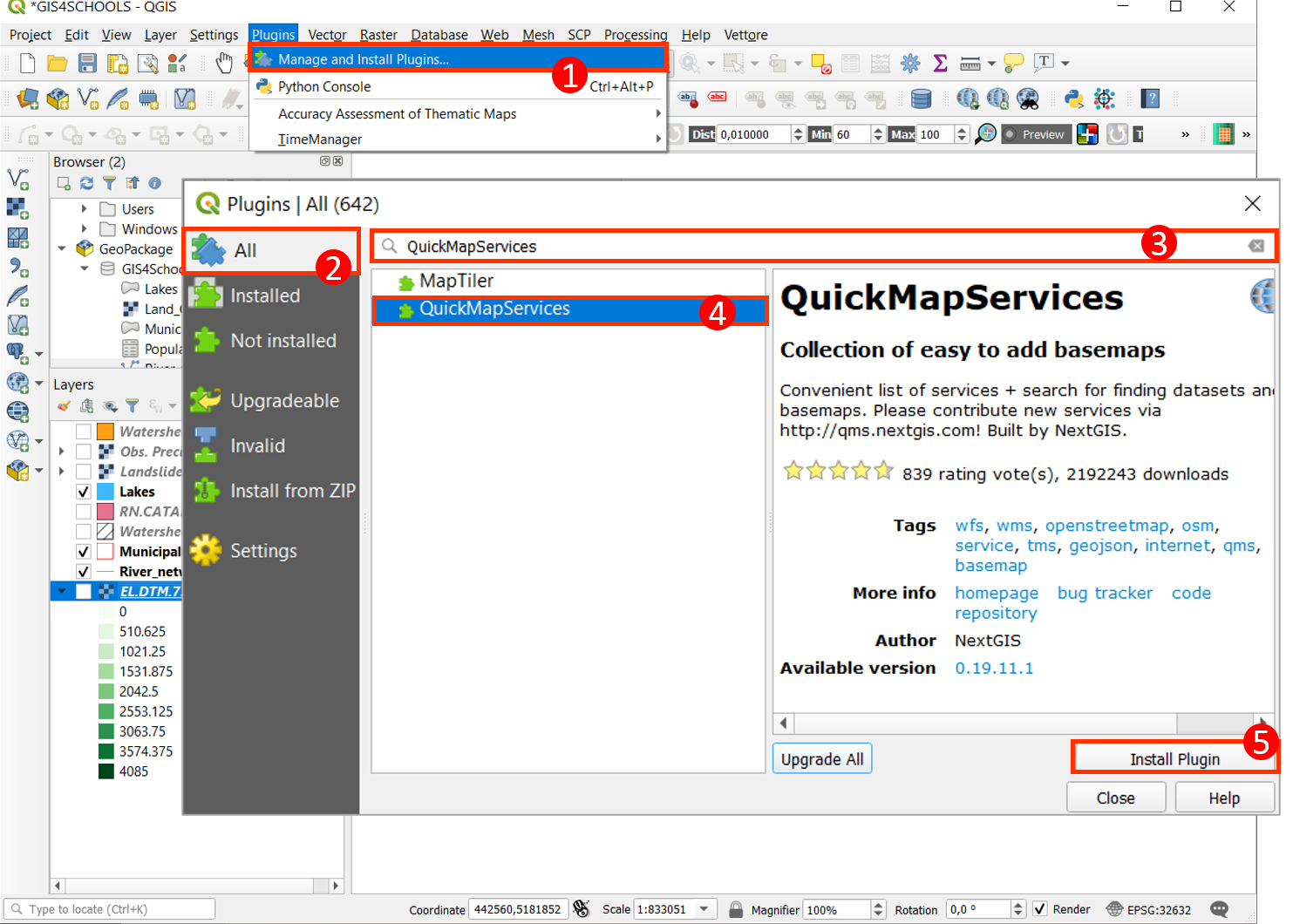
Fig. 2.3.2.1 – Installing QuickMapServices Plugin
Once the plugin is installed, you find it under the Web in the Main Menu (Fig. 2.3.2.2. There are a huge number of possible maps. Let us suppose that we are interested in OSM Standard. Click Web → QuickMapServices (1) → OSM (2) → OSM Standard (3). The OSM Standard map is added as a background of our project. This is simply an image and therefore it is not queryable but very often it is useful to give a quick contextualisation to our data.
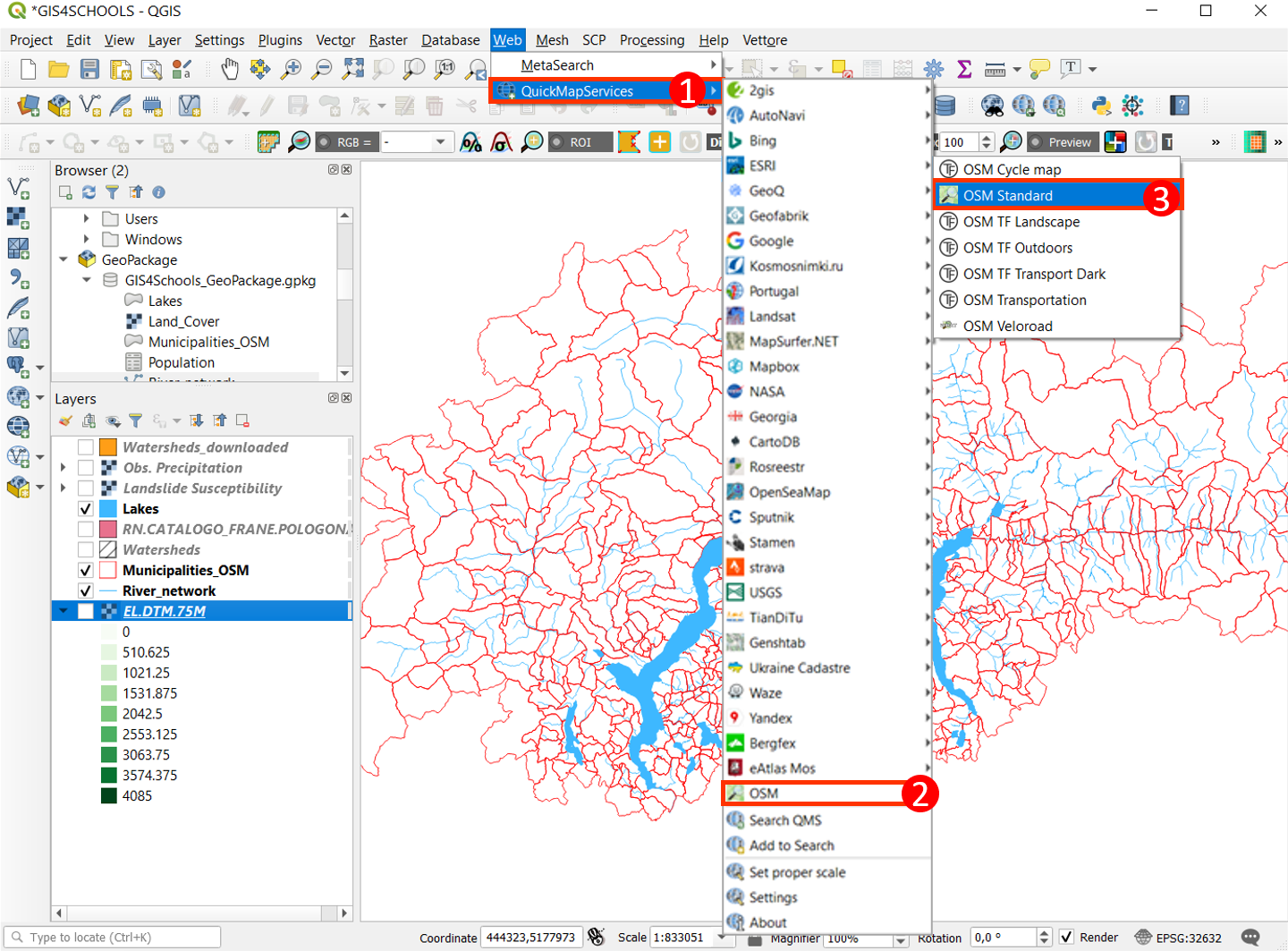
Fig. 2.3.2.2 – Opening the OSM Standard basemap
If you want to be sure to connect to the whole dataset of contributed services, from the QuickMapServices menu select Settings → More Services → Get contributed pack.
A second interesting plugin helps us download selected data from the OpenStreetMap (OSM) database. OSM is an editable vector map of the whole world built by volunteers. It is the largest, most diverse, most complete and most up-to-date geospatial database. OSM is open data, licensed under the Open Data Commons Open Database License (ODbL) by the OpenStreetMap Foundation (OSMF).
You are free to copy, distribute, transmit and adapt OSM data, as long as you credit OpenStreetMap and its contributors (using the credit: “© OpenStreetMap contributors”). If you alter or build upon OSM data, you may distribute the result only under the same licence.
In OSM a geographic feature (object) is represented by its geometry (node, way, or relation) and tags that describe the attributes of the feature. here are three geometries:
- node, which represents a point in space,
- way, which defines a linear feature (polyline→initial and final nodes don’t coincide) or an area boundary (polygon→first and final nodes coincide),
- relation, which is an ordered list of nodes, ways, and other relations.
Tags are the object attributes that are composed of a key and a value (key=value). An object must have at least one tag, and it can have any number of tags.
Map Features are agreed tags within the OSM Communities and a list where they are grouped by key meaning is available.
Examples:
- building = yes is the tag used for a building when it is not possible to determine a more specific value.
- building = school is the tag used for any generic school buildings. But, amenity=school is used for the perimeter of the school grounds.
With the QuickOSM plugin, we can download the features we are interested in (Fig. 2.3.2.3). After installing it, we find it under the Vector Menu or as an icon (1). In the following we will download generic buildings in the area covered by the GIS4Schools geopackage. For doing so, we have to zoom to that layer and then to select the Key building (2) and the Value yes (3) in the Quick query dialog. As we have already zoomed to the interested area, we choose the Canvas extent (4) as the area where to extract the buildings. Then, click Run query (5).
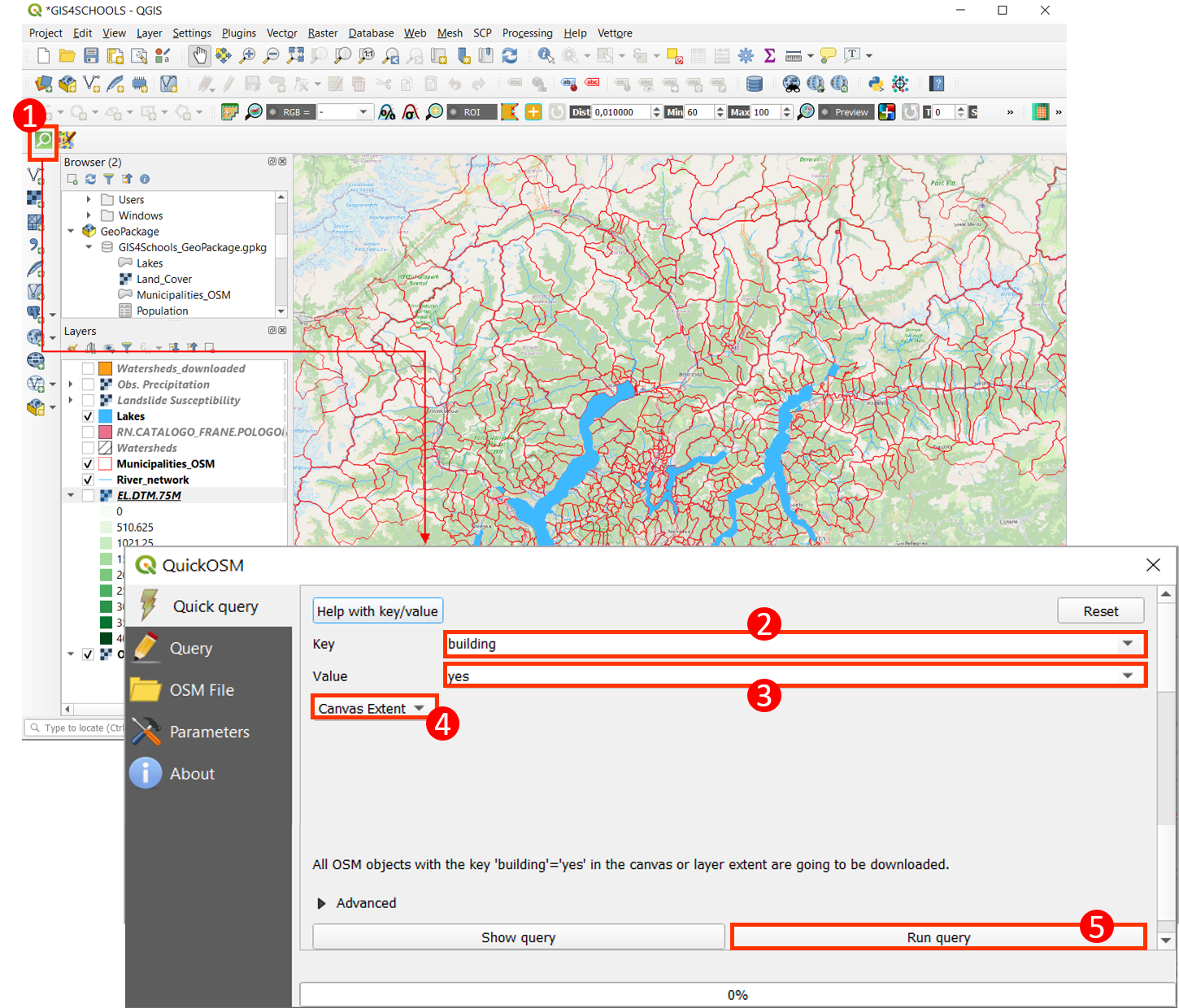
Fig. 2.3.2.3 – The QuickOSM plugin interface
The global result is shown in Fig. 2.3.2.4 while in Fig. 2.3.2.5 we can see a small detail.
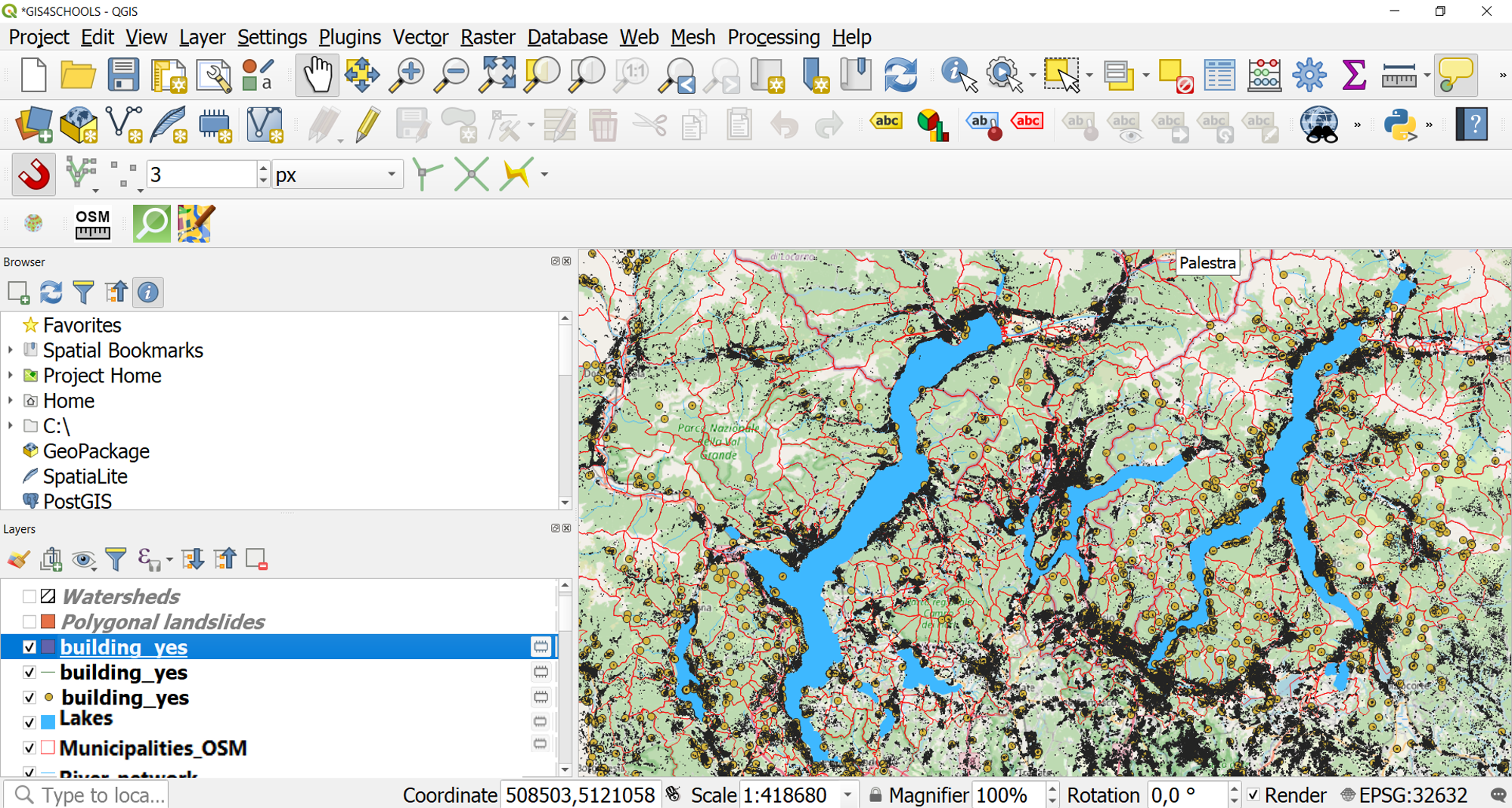
Fig. 2.3.2.4 – Global result of the QuickOSM
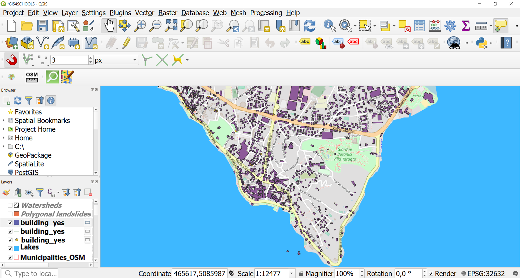
Fig. 2.3.2.5 – Detail of the result of the QuickOSM